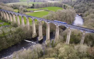
The Staffordshire & Worcestershire Canal runs through softly undulating West Midlands countryside. It skirts around the edges of Birmingham without ever becoming truly urban.
The canal, known locally as the 'Staffs & Worcs', was one of the major routes of the canal age, and would have been constantly busy with coal boats. It now forms part of two cruising rings, and is one of the prettiest ways to explore the region.
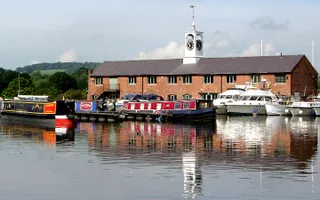
At one end, it connects to the River Severn at the historic Stourport Basins in the Georgian town of Stourport. The southern reaches of the canal run close to the River Stour, which is an important wetland habitat. The canal near Kidderminster and Kinver has unusual sandstone 'cliffs'.
At its northern end, in Staffordshire, it runs through the wild pine woods and heathland of Cannock Chase. It then passes the grounds of the grand Shugborough Estate, before joining the Trent & Mersey Canal.
Days out on this canal
The history
The Staffordshire & Worcestershire Canal was promoted at the same time as the Trent & Mersey Canal, mainly by Wolverhampton businessmen, and it received its Act on the same day, 14 May 1766. James Brindley was appointed surveyor. Construction proceeded quickly, the southern section from Compton (near Wolverhampton) to the Severn opening in 1771, the rest of the canal northwards opening the following year.
The southern section served several ironworks, coal from the Ironbridge Gorge being brought down the Severn then up the canal. Much more traffic was gained when other canals joined the Staffs & Worcs: the Birmingham Canal at Aldersley Junction in 1772 and the Stourbridge Canal at Stourton Junction in 1779. Once the Trent & Mersey was completed in 1777, the northern section of the Staffs & Worcs became part of the canal route from Birmingham and the Black Country to the Mersey ports.
Stourport Basins
At Stourport a basin was made where coal from the Dudley Canal and manufactured goods were transshipped from narrow boats into Severn trows. The settlement here quickly grew into a town, with warehouses, inns, and industries such as boat-building, tanneries, ironworks and mills. Over the years, further basins were added.
The canal passed over a mile to the south of Stafford. A horse tramroad was opened from Radford wharf in 1805, and in 1816 the River Sow was made navigable up to the town and a connecting lock built. Another valuable link was made when the Hatherton Branch of the Wyrley & Essington Canal opened in 1841.
Some traffic was lost when the Worcester & Birmingham Canal opened in 1815, providing a more convenient route from Birmingham to the Severn. More was lost when the Birmingham & Liverpool Junction opened in 1835, with its shorter and easier route to the Mersey ports, but Staffs & Worcs were granted a compensation toll on all traffic passing to or from it.
Nevertheless, the canal continued to be prosperous. Unlike its neighbours, it was never sold or leased to a railway company, staying independent until nationalisation in 1948. The last regular commercial traffic was coal from Cannock to Stourport power station, which ceased in 1949.


