Is the dam wall safe?
Yes. The reservoir is drained to near empty while investigations and a major repair/reconstruction programme are carried out. Water levels are being continuously monitored and 11 high volume pumps are in place to keep the reservoir near empty.
As part of the first phase of restoring Toddbrook Reservoir, an important repair project to the dam's damaged auxiliary spillway was completed in summer 2020, greatly increasing its resilience against extreme weather events.
A protective, waterproof nib or short wall was added to the crest of the dam wall above the damaged spillway. This reaches down to create a seal with the dam's clay core and ensures no water from inside the reservoir can penetrate beneath the concrete slabs at the top of the spillway.
The spillway crest has also been increased in height by just over one metre with the installation of a sturdy waterproof concrete wall. Engineers completed the job with the installation of new pressure relief holes and joint repairs on the spillway.
The reservoir will remain drained throughout the repair project.
What did the emergency response involve?
Between Thursday 1 August and the following Wednesday (7 August), over one billion litres of water were pumped out of the reservoir into the River Goyt – working with the Environment Agency to avoid downstream flooding. This lowered water levels in the reservoir by over ten metres.
An RAF Chinook helicopter dropped over 600 one tonne bags of aggregate onto the damaged section of spillway to reinforce the structure and grout was poured around the bags to bind them in order to further strengthen the dam.
At the same time, work to divert the flow from Todd Brook into the bypass channel took place to prevent it filling back up.
How was the damage caused?
The two independent reports agree that “poor design” of the spillway, added in 1970, was the underlying cause of the partial failure of the auxiliary spillway at Toddbrook Reservoir on 1 August 2019.
Read the two independent reports in full here.
- Independent review, commissioned by Defra (Department for Environment, Food and Rural Affairs), led by Professor Balmforth, former President of the Institution of Civil Engineers.
- Independent review, commissioned by the Canal & River Trust from eminent dam expert Dr Andrew Hughes.
Why was the spillway added in the first place?
The dam was originally constructed between 1837 and 1840 as an earth embankment, with a puddle clay core. On 12 December 1964, an extreme rainfall event damaged the original smaller (primary) spillway. This led to the Inspecting Engineer requiring the overflow capacity to be increased considerably. Between 1969 and 1970, an auxiliary spillway 76m long and 0.26m above the original spillway, was constructed on the face of the embankment to provide extra overflow capacity for extreme weather events.
What measures are you taking to keep the reservoir safe?
We have expert teams of hydrologists and engineers who are constantly monitoring water levels and reacting to changes in the weather. A range of the latest water measurement gauges are sited around the reservoir. These help to alert the Trust when action needs to be taken to open valves or activate the 11 high volume pumps sited at Toddbrook while repairs are carried out.
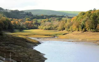
Toddbrook Reservoir is almost fully drained and water levels will remain at this near-empty level for the entire duration of the repair project.
What other reservoirs are of a similar design to the Toddbrook Dam? Are they safe?
The Trust has identified a small number of reservoirs with some similarities to Toddbrook and we are taking precautionary measures pending further investigation. This includes holding water levels down and undertaking regular inspections. Any reservoir requiring additional safety works will receive that investment over the next 2-3 years.
Will boating be affected by the closure of the reservoir?
The Toddbrook Reservoir was built in the 1830s to feed the Peak Forest and Macclesfield canals. While repairs take place, the Peak Forest will rely on a reduced supply from nearby Combs Reservoir and other water sources.
What are the problems with the Combs reservoir feeder? Why is the Trust using pumps?
The Trust carried out extensive dredging and bank repairs to the Combs Reservoir feeder over autumn/winter 2019/20 to improve its flow into the Peak Forest Canal at Whaley Bridge.
However, detailed investigations and internal camera inspections of the culverted sections within Whaley Bridge have highlighted a number of challenging blockages severely restricting the flow.
In order to secure the important water supply from Combs into the Peak Forest Canal at this vital time while Toddbrook is out of action, the Trust has worked closely with the Environment Agency to set up a temporary pumping arrangement while a long term solution is developed.
This temporary solution involves diverting the water flow from Combs Reservoir into Randall Carr Brook and the River Goyt and then pumping an equivalent quantity of water back into the Peak Forest Canal in Whaley Bridge. This temporary arrangement has an Environment Agency licence and is closely monitored on a daily basis.
The Trust is currently examining all available options for finding a long term solution to the current situation and will be providing a further update soon.
What has happened to the fish in the reservoir?
We estimate that there were about 30,000 fish (about 5 tonnes) in the reservoir at the start of the dam emergency in August. As the water levels were reduced, we carried out an emergency fish rescue as part of the main drawdown in early August, followed by two further rescues in October and December 2019.
Coarse fish, such as, roach, perch and pike, were captured in large nets by the Trust's fish specialists and then transported to another Trust reservoir, Upper Bittell Reservoir, near Birmingham.
Upper Bittell Reservoir was drained and then refilled after maintenance works a few years ago and is in a good position to re-home large numbers of fish.
How does the Canal & River Trust inspect its reservoirs?
The Canal & River Trust manages 72 reservoirs and has an experienced team of specialist reservoir engineers. These engineers are appointed into the role by the Secretary of State for the Environment on the advice of the Institution of Civil Engineers. Their inspections meet the industry's highest standards.
As well as visual inspections twice a week by Trust operatives, our reservoirs are rigorously inspected twice each year by our reservoir supervising engineers and also undergo detailed ten yearly inspections by an independent Inspecting Engineer (from the Government-appointed Panel). These inspections consider the best industry-wide knowledge regarding dam construction and stability. We prioritise spending money on reservoirs wherever a need for maintenance work and/or repairs is identified.
When was Toddbrook Reservoir last inspected?
The dam is visually inspected three times weekly by Canal & River Trust trained operatives and rigorously inspected twice each year by our skilled reservoir engineers. It also undergoes a detailed ten yearly inspection by an independent Inspecting Engineer – the most recent one at Toddbrook took place in November 2018, with the report received by the Trust in April 2019.
Has the Trust considered the effects of climate change on its historic dams?
The standards by which our structures are measured and assessed are constantly being reviewed. This would include any learning from the impact of changing weather conditions.
Can the spillway be rebuilt or repaired?
Two options have been selected for further assessment, in accordance with the recent public consultation. Both options include a new spillway as opposed to re-building the existing auxiliary spillway. The Trust will be publishing a report in mid October to explain the reasoning behind these two options being selected.
Why has flood lighting been installed next to the reservoir?
The lights are needed to monitor water level gauges overnight. Following feedback from local residents we have made modifications to minimise disruption to local residents.
When will the reservoir footpath by the sailing club be re-opened?
The footpath which runs alongside the northern side of the reservoir from Reservoir Road to the inlet is now open for a few months over winter 20/21. Due to safety reasons, it will need to be closed again when the major repair work starts in spring 2021. The footpath over the dam wall will only reopen to the public when the entire project is completed in 2023.
Will the reservoir be made deeper?
The depth of the reservoir is less than when it was constructed due to siltation and now is around 14m at its lowest point. We do not have any plans to make the reservoir deeper or undertake silt removal from the bed of the reservoir.
Will the land around the reservoir, including the footpaths, be restored to their original condition?
Yes, all the surrounding land owned by the Canal & River Trust will be re-opened once the project has been completed. We are not able to confirm plans for land owned by third parties.
Could the reservoir be made smaller?
The current capacity of the reservoir supports the Peak Forest and Macclesfield canals. A reduction in its size would make it much harder to successfully operate these two canals.
Do we need the reservoir? Could it be adapted to create a special environmental site with wildflower planting?
The reservoir is already designated a Site of Special Scientific Interest and we need the current capacity to feed the Peak Forest and Macclesfield canals.
Can a dedicated reservoir keeper (water bailiff) be re-instated to live on site to monitor and open sluice valves?
The Trust has inspection and water control regimes in place to manage the reservoir in accordance with the Reservoirs Act. In an extreme event such as the one experienced last year, opening valves would make no substantive difference to water levels, and a new spillway is required to safely convey flows in extreme events.
The bridge over the dam has been in a poor condition for several years but has recently been reinforced. In future will the Trust ensure that it's safe and well-maintained?
Works to the decking on the bridge have been reinforced to support the construction operations at the site. This bridge will be removed in the two options being considered, and the embankment grassed over with a path along the crest. A new bridge will be installed across the new spillway.
Is the Trust doing anything to educate young people about the reservoir?
We've been liaising with local schools to arrange special talks and visits. Nationally we run an Explorers programme for young people and we will hope to link into this with future activities.
As clay cracks when not under water, will the Trust be doing anything to water the clay core?
At depth, we don't anticipate the clay core will dry out significantly. When we come to refill the reservoir, this will be done in a controlled fashion to give the dam time to rehydrate. All works will be completed in consultation with reservoir experts.


