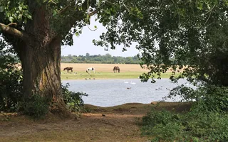
Oxford, city of ‘dreaming spires', is a world-famous seat of learning with its historic university, founded as early as 1264. The River Thames is important to the city and the Oxford Canal connects with it via Isis Lock at its most southern point, and higher up via the short Duke's Cut. This walk is a glorious mix of heritage and nature, worth every step you pace, taking you along Oxford Canal's green corridor through to the wide open expanse of the rural River Thames, with birdsong for company and views of grazing horses and cows.
Circular walk in Oxford
Blow away the cobwebs with this scenic walk around a historic city, taking in rural views of the Oxford Canal and River Thames.

Canal: Oxford Canal
Start and finish: Isis Lock OS Grid ref: SP505066 Postcode: OX1 2RQ
Distance: 8.4km / 5¼ miles
Route instructions
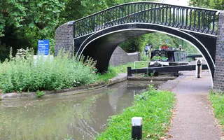
Start: Isis Lock sits in a calm leafy setting close to the city, and drops the Oxford Canal to the Sheepwash Channel. The lock's distinctive Grade II-listed iron turnover bridge enabled working boatmen to save time by walking their horses up and over the bridge without needing to untie them from the boat entering the lock.
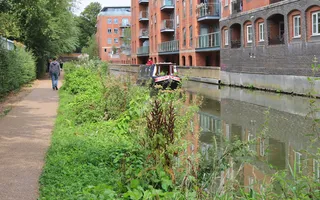
1. Follow the towpath north alongside Castle Mill Stream and the railway, with boats moored on both sides of the canal. Jericho Wharf on the opposite bank, overlooked by the campanile of the Grade I-listed St Barnabas Church, has long been the focus of a battle to conserve the boatyard as part of a sensitive community development.
2. Most bridges along the canal were built in the 1790s by engineer James Brindley and are now Grade II-listed. Just beyond Walton Well Bridge, the leafy towpath passes rows of gardens opposite, many clearly enjoying their position by the water.
3. Frenchay Bridge, near Trap Grounds Local Wildlife Site, and Elizabeth Jennings Way Bridge are colourfully decorated with murals as part of the Oxford Canal Mural Project. Long stretches of the canal and its banks are designated Conservation Areas, protecting species such as the elusive water vole.
4. The towpath runs through a linear residential community of moored boats, passing St Edward's Lift Bridge (usually open). Just beyond the railway bridge, the railway nears the towpath before another boating community just beyond Balls Bridge.

5. At the pretty setting of Wolvercote Lock, climb steps up to the road and turn right over the railway. The huge expanse of Port Meadow, thought to have been grazed without interference for over 4,000 years, spreads out on your left. Keep straight through Wolvercote, following Godstow Road as it branches left at Jacob's Inn, until you reach the Trout Inn.
6. Cross the historic twin-arched Godstow Bridge, then the newer bridge before following Thames Path signs to head south beside the River Thames. Be aware of any flood warnings, and note the path can be muddy after rain. You are now on part of the 183-mile Thames Path National Trail.
7. A Benedictine nunnery dating from the 12th century, the Grade II-listed walled ruins of Godstow Abbey are also the burial place of ‘Fair Rosamund', mistress of Henry II. The Trout Inn, built as a hospice in 1138 and featured in TV's Inspector Morse, is the best remaining part of the original Abbey, dissolved in 1539 by Henry VIII, and destroyed in the Civil War.
8. Continue through gates past Godstow Lock, built to bypass the nearby weir. Glorious expansive views open up across to the meadow and its grazing horses or cows, while lush trees, bushes and wild flowers line your path.

9. The river is peaceful even if busy with boats and canoes or kayaks, and there are many spots to picnic or just sit and watch. Gangs of geese and swans vie for position on the water. If you're lucky, you'll see them take off or land en masse. Keep your eyes peeled for heron, kingfishers and hedgerow birds too.
10. Moored boats indicate the Perch at Binsey and, shortly after passing a boatyard, you cross over the Thames via Medley Footbridge. Continue past moored boats and over another footbridge to follow a more enclosed tree-lined path between waters.
11. Turn left into Sheepwash Channel, reputedly so-called as farmers used to bring their flocks of sheep for dipping. Mind your head as you walk under low railway bridges and follow the path up and across Rewley Road. The now listed railway swing bridge, designed by the world-famous Robert Stephenson, is currently under restoration.
End: Cross the footbridge over Castle Mill Stream before arriving back at Isis Lock.

Last Edited: 11 February 2025


Stay connected
Sign up to our newsletter and discover how we protect canals and help nature thrive


