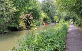
This leafy walk follows the Oxford Canal's green corridor as it heads away from the city. Oxford, city of ‘dreaming spires', is a world-famous seat of learning with its historic university founded as early as 1264. The River Thames is an important feature of the city and the canal is connected to it via Isis Lock at its most southern point, and higher up via the short Duke's Cut. Ambling along this towpath, it's hard to imagine the Oxford Canal was once part of a busy major freight route between London and the Midlands.
Canal walk in Oxford
Enjoy a level walk along the Oxford Canal from Isis Lock to Duke's Cut. This leafy stroll is just under 3 miles long - or 6 miles if you go there and back.

Canal: Oxford Canal
Start: Isis Lock OS Grid ref: SP505066 Postcode: OX1 2RQ
Finish: Duke's Cut OS Grid ref: SP488106 Postcode: OX2 8JT
Distance: 4.4km / 2¾ miles
Route instructions
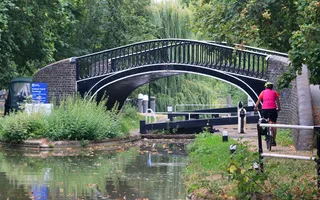
Start: The River Thames is an important feature of Oxford. The canal is connected to it via Isis Lock and the Sheepwash Channel at its most southern point, and again higher up via the Duke's Cut. Isis Lock, in a calm leafy setting close to the city, drops the canal down to the Sheepwash Channel. Its distinctive Grade II-listed iron turnover bridge enabled working boatmen to save time by walking their horses up and over the bridge without needing to untie them from the boat entering the lock.
1. Head north to follow the towpath alongside Castle Mill Stream and the railway, with boats moored on both sides of the canal. Jericho Wharf on the opposite bank, overlooked by the campanile of the Grade I-listed St Barnabas Church, has long been the focus of a battle to conserve the boatyard as part of a sensitive community development.
2. Many of the bridges along the Oxford Canal were built in the 1790s by engineer James Brindley and are now Grade II-listed. Just beyond Walton Well Bridge, the leafy towpath passes rows of gardens opposite, many clearly enjoying their position by the water.

3. Near Trap Grounds Local Wildlife Site, Frenchay Bridge and Elizabeth Jennings Way Bridge are both colourfully decorated with murals as part of the Oxford Canal Mural Project. Long stretches of the canal and its banks are designated Conservation Areas, protecting species such as the elusive water vole.
4. Continuing northwards, the towpath runs through a linear residential community of moored boats, passing St Edward's Lift Bridge which is usually left open. Just beyond the railway bridge, views open up over allotments opposite as the railway as nears the towpath. Another linear boating community spreads from Balls Bridge towards Wolvercote.
5. Wolvercote Lock and bridge sit in a pretty setting just by the railway. A short detour along the road towards Wolvercote shows the top edge of the huge expanse of Port Meadow, thought to have been grazed without interference for over 4,000 years. It runs alongside the River Thames most of the way back down to Oxford.

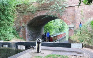
6. Signage on the towpath announces residential community moorings from here past a lift bridge through to the A34 flyover, which starts to make its presence felt as you approach. Wolvercote Lift Bridge sits just beyond its shadow and, almost immediately, another main road, the A40, crosses the canal on a more appealing skewed brick bridge.
7. The canal widens and there are expansive views over the fields opposite at the junction with Duke's Cut, a short connection between the Oxford Canal and the River Thames. The Duke's Cut was created in 1789 for the Duke of Marlborough, owner of Blenheim Palace and major shareholder in the Oxford Canal, to provide a quick route from the Oxford Canal to his paper mill at Lower Wolvercote.
8. Walk up and over the Grade II-listed red-brick bridge at the junction. The Oxford Canal continues straight through Duke's Lock next to its pretty lock cottage. Next to the cottage are the historic remains of animal feeding troughs and the entrance to Duke's Lock Pond Local Wildlife Site, an important wetland habitat. Look out for dragonflies, willow warblers or perhaps a kingfisher.

End: Grade II-listed Duke's Cut Lock was originally designed to allow for variations in the level of the River Thames, using two lock gates rather than the usual one. You can still see the recesses for the second gate though this is no longer used. Once you've finished exploring, it's time to retrace your steps back along the canal to Isis Lock, or hop on a bus from Wolvercote back to Oxford.

Last Edited: 18 February 2025


Stay connected
Sign up to our newsletter and discover how we protect canals and help nature thrive


