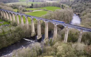
Travelling from Wakefield you'll pass over the Stanley Ferry Aqueducts which sit side-by-side, one having been built in the Victorian era and the other in 1981.
You'll then pass by Whitwood Wharf, which until recently was the furthest inland that commercial barges could come from the sea at Goole.
As you near Castleford you'll pass Fairies Hill Moorings. The moorings sit on the site of a former coal wharf where ‘tom puddings' (rectangular iron tub-boats, 21ft long and 15ft wide) were filled up with coal for the collier ships at Goole.
This information has been put together with the help of Mel Smith. If you have know any interesting facts about the Wakefield Branch please let us know via our Contact us form
The history
Although originally built under the Aire & Calder's first Act of 1699, much of the route today dates from improvements in the 1820s. The original terminus on the river at Wakefield still survives, but is not navigable. Today, boats use the canal on the other side of the river which was built by the Calder & Hebble Navigation to connect with the Aire & Calder.


