About our restoration map
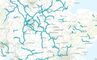
This map illustrates purposely constructed canals. Please note that we have not been able to include all branches and waterways on this. We have focused on our waterways where volunteer groups are working to restore the waterways to full navigation.
The map starts in the 1700s, although we do acknowledge that some waterways were navigable long before this, including the Fossdyke, which was used by the Romans.
A number of proposed new navigations are included on the map.
Mileage: For each of the time phases of the map, a figure has been included for mileage. Please note that this figure is approximate and for illustrative purposes.
Could you help us?
Mapping when waterways have opened, closed and been restored is a big job. Many records and details of canals have been lost.
This our first attempt to show the growth and shrinkage of the network, so we would welcome your help. If you spot an issue or would like to give some feedback, please email us.


