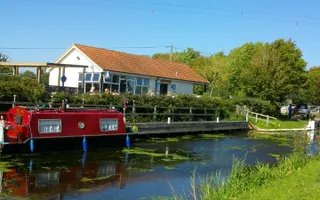
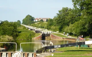
This beautiful Somerset canal might be cut off from the rest of the system, but its well-maintained towpath and fascinating lock structures make for idyllic walking and peaceful boating.
While the Bridgwater & Taunton Canal connects the two towns of Bridgwater and Taunton, the majority of the canal is rural, making it a wonderful spot for nature enthusiasts.
One of the canal's highlights is the unique Somerset Space Walk. A scale model of the sun can be found at Maunsel Lock, with planets set along the towpath for six miles in both directions, demonstrating the scale of the solar system. Although, the whole canal offers a number of ways to enjoy our waterways everyday with walking routes, canoe trails and even great fishing spots.
The history
The Bridgwater & Taunton Canal skirts its way in splendid isolation around the base of the Quantock Hills for a little over 14 miles. Its tranquil seclusion belies the fact that it is one of very few sections to be built in a grandiose, but ultimately doomed, plan to link the Bristol and English Channels.
Nevertheless, the canal slotted neatly into Somerset's evolving, self-contained network of navigable waterways:
- the River Parrett and its extensions
- the Ivelchester & Langport Navigation (not complete) and the Westport Canal
- the Chard Canal, a tub boat canal, which had four inclined planes
- the Grand Western Canal, which had one inclined plane and seven lifts (the remains of the one at Nynehead are well worth visiting)
Bristol, South Wales and beyond
Opened in 1827, the Bridgwater & Taunton Canal met the River Parrett at Huntworth and in 1841 it was extended round the town of Bridgwater to new docks below the town bridge and the access at Huntworth was closed. Its principal cargoes were coal and iron from across the channel in South Wales, with agricultural goods filling the boats on their return journeys.
The Bristol & Exeter Railway bought the canal in 1866 and constructed a branch to the docks.
By the turn of the 20th Century, commercial carrying on this rural waterway had all but ended and the canal found a new role as a water supply. Access to the fiercely tidal Parrett was curtailed and during World War II swing bridges were secured in position for security purposes. So although the line contained water, it was not navigable by anything more than a canoe or dinghy. Full access to the River Parrett only stopped for ships in 1971, although the Barge Lock continued until 2002 when the lock was sealed.


